
Alaska · Arctic hydrology
Where does
Alaska’s water go?
A changing climate. A changing water balance.
I study how much precipitation becomes runoff—and why that fraction changes.
01 / The question
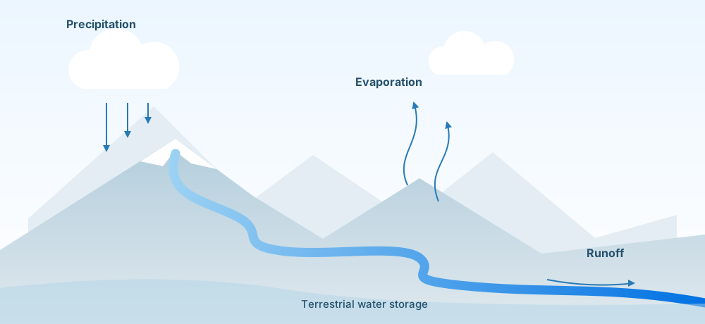
One ratio.
A view of the water balance.
R/P is the fraction of precipitation that becomes runoff. I examine how it varies across Alaska’s climate regions, how it may change under mid-century warming, and which processes contribute to those changes.
About this research
Historical and projected changes in Alaska’s runoff-to-precipitation ratio. Research at the University at Buffalo’s A.C.T. Hydrology Lab, advised by Dr. Yifan Cheng.
02 / The data
Regional questions.
High-resolution data.
I analyze existing RASM simulation data to examine historical patterns and projected changes across Alaska.
Spatial resolution
of the RASM dataset
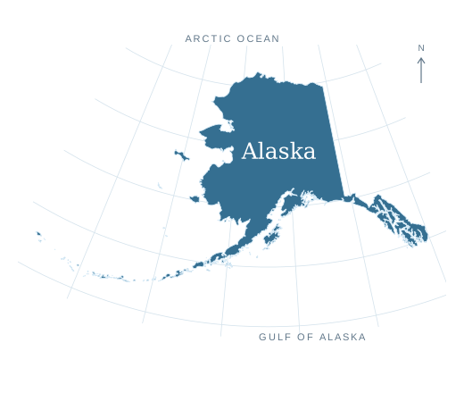
Understand the baseline.
Examine how R/P varies across Alaska’s diverse climate regions.
Explore a warmer climate.
Compare historical conditions with mid-century warming scenarios.
Inside the RASM framework
The RASM configuration used to produce the dataset couples the WRF 3 atmosphere and CTSM land model through CPL 7. Sea-surface temperature and sea ice are prescribed from ERA5; streamflow is computed offline with MizuRoute.
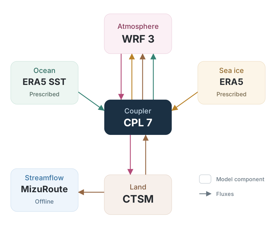
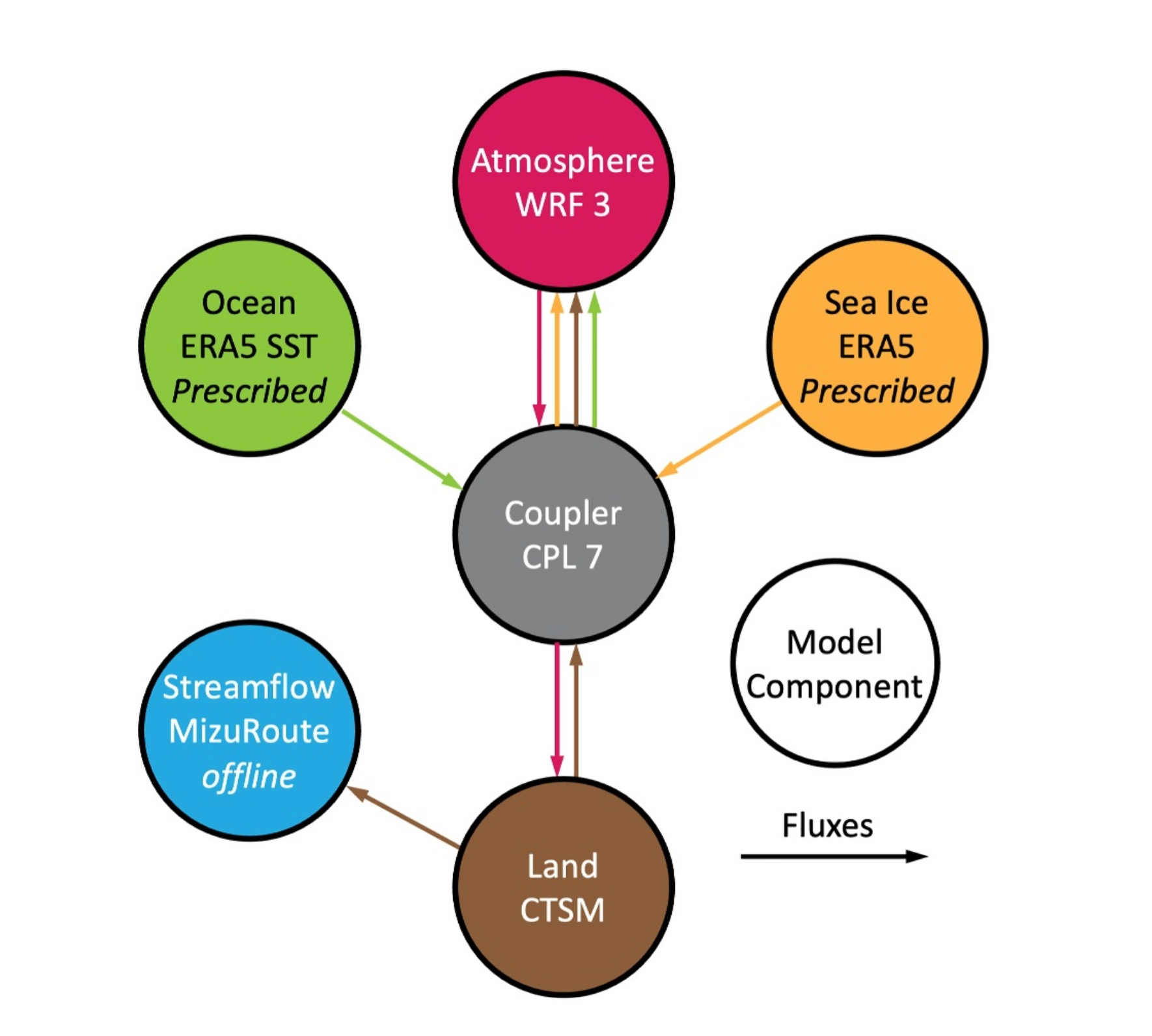
This is the model framework behind the data. My work analyzes its outputs using the Budyko-based attribution framework described below.
Dataset, scenarios & analysis tools
- Dataset
- 4-km RASM coupled land–atmosphere simulation data.
- Scenarios
- Historical conditions, PGW and DDD scenarios.
- My contribution
- Geospatial analysis and water-energy balance attribution of R/P changes.
- Tools
- Python and a Budyko-based attribution framework.
03 / The explanation
See the change.
Investigate the drivers.
A change in runoff is the starting point. I use a Budyko-based water-energy balance framework to separate the contributions of four controlling factors.
Water supply
Precipitation entering the system.
Evaporative demand
The atmosphere’s potential demand for water.
Water storage
Changes in terrestrial water storage.
Basin characteristics
Effective basin properties represented in the framework.
How the attribution fits together
The analysis uses a Budyko-based framework to attribute changes in R/P to precipitation supply, evaporative demand, terrestrial water storage, and effective basin characteristics. These contributions provide a framework-based interpretation of the regional hydrologic response.
04 / Related experience
Different landscapes.
Connected questions.
Previous projects explore sea ice, coastal ecosystems, and river runoff.
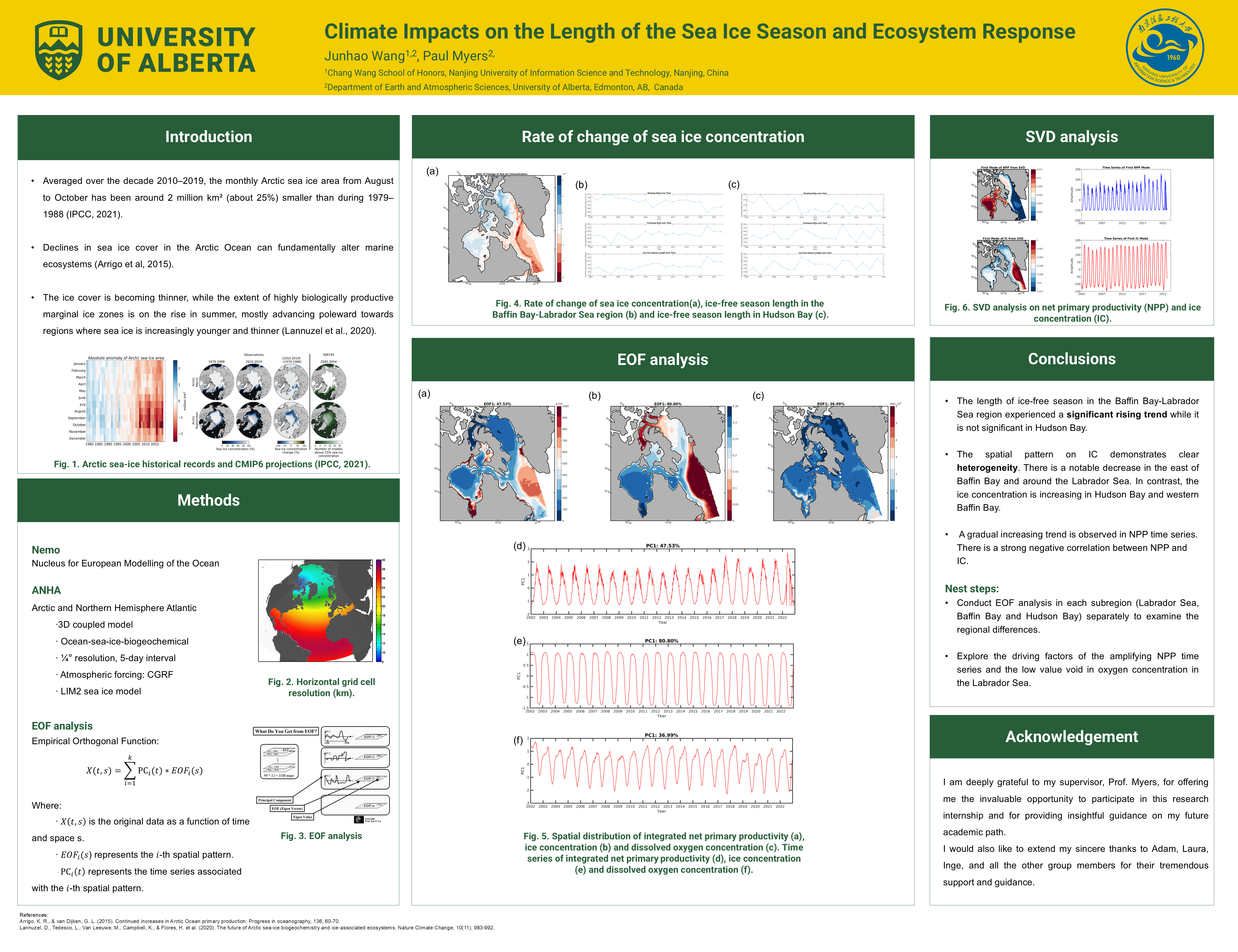
MITACS Globalink Research Internship · 2024
Climate impacts on sea-ice season and ecosystem response
Supervisor: Prof. Paul Myers, University of Alberta
Explore the methods
- Analyzed changes in sea-ice concentration, thickness, and spatial structure in Baffin Bay, the Labrador Sea, and Hudson Bay.
- Evaluated ice-free-season changes through breakup and freeze-up timing.
- Examined relationships between sea-ice change and biogeochemical patterns.
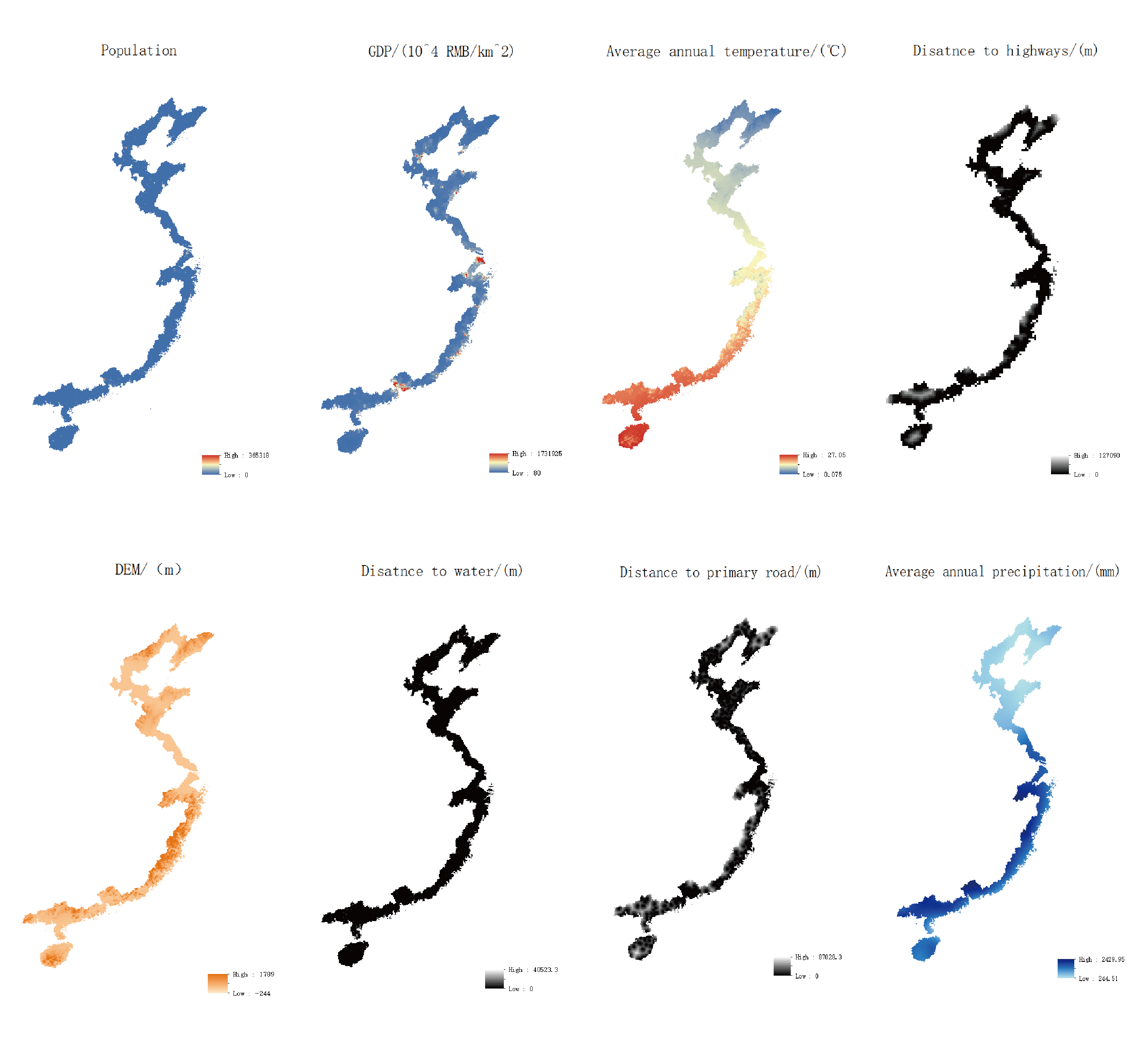
NUIST · 2023–2024
Land-use change and habitat quality in China’s coastal zone
Supervisor: Prof. Chengyi Zhao
Explore the methods
- Coupled PLUS and InVEST to project land-use patterns and assess habitat quality from 2020 to 2060 under three SSP scenarios.
- Evaluated drivers of habitat-quality change and the contribution of land-cover transitions to ecosystem degradation.
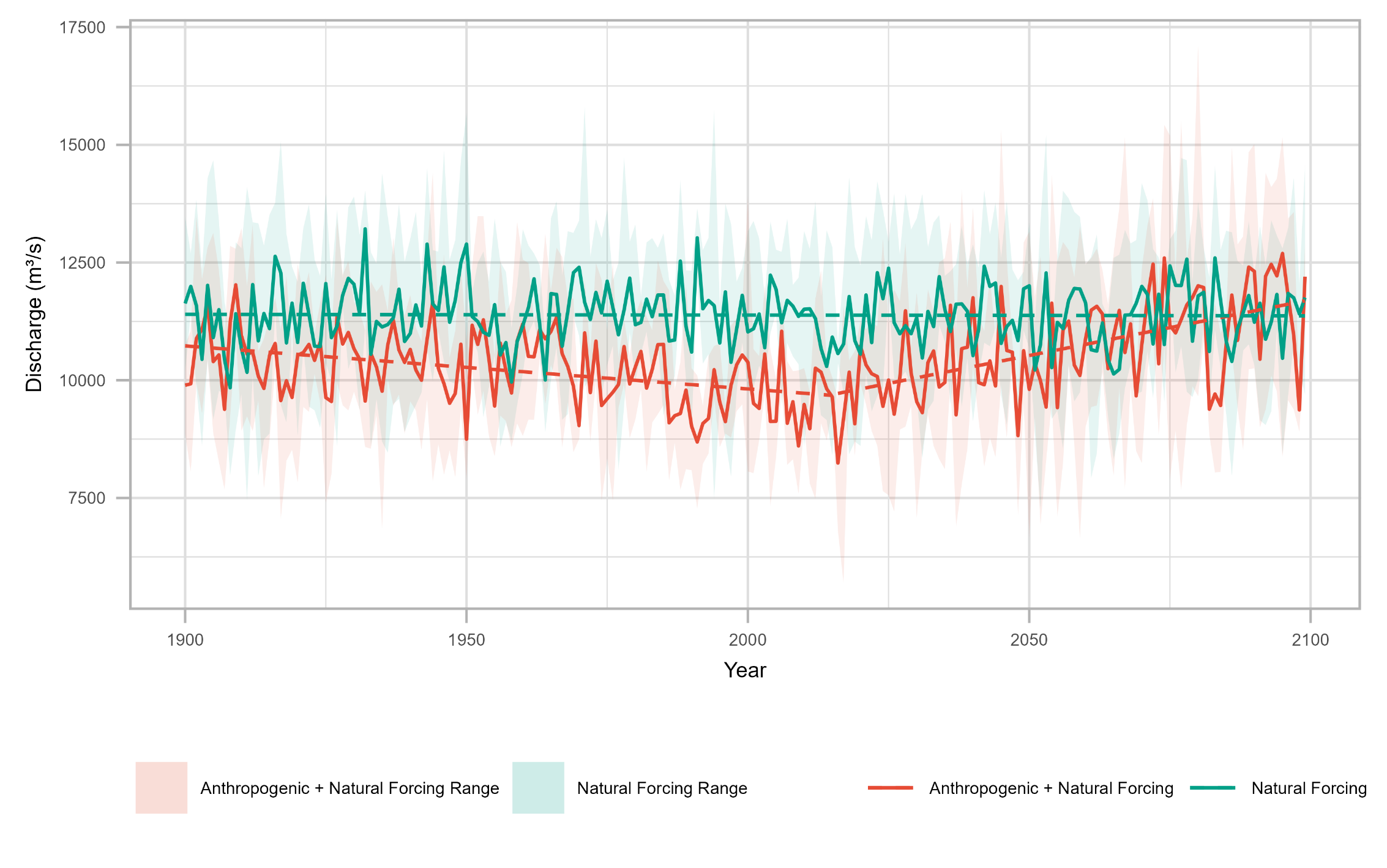
NUIST · 2022–2024
Anthropogenic climate-change impacts on upper Yangtze runoff
Supervisor: Prof. Buda Su
Explore the methods
- Developed a random-forest model using temperature and precipitation to estimate runoff under different forcing scenarios.
- Compared anthropogenic-plus-natural and natural-only forcing to assess changes in annual, monthly, and extreme discharge.